Help ×
Go to the help page...
Help Videos


Real estate information ×
New Request
Excerpts ×
Ownership information on map section
Stellt die Eigentumsinformationen mehrerer ausgewählter
Grundstücke zusammen.
Liegenschaftskenndaten (Riehen)
Erstellt eine Zusammenstellung der wichtigsten Informationen zu
einem einzelnen Grundstück.
Earthquake micro-zoning
Creates an earthquake micro-zoning excerpt for the location selected.
Import map layers ×
Selection-Tool ×
Draw & Measure ×
Filter map content ×
No filtrable layer available!
Profil zeichnen ×
Street View ×
Click on a road on the map to start StreetView.
MapBS 3D ×
Please select a mode and a location on the map:
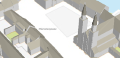
3D city model: MapBS 3D opens for the selected map location with the 3D city model.
Bird's eye: MapBS 3D opens at the selected location on the map and displays the oblique aerial view facing north.
More applications ×
PLR-cadastre portal
Cadastre of Public-law Restrictions on landownership (PLR-cadastre)
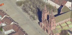
Merian plan
Bird's eye view of the city of Basel by Matthäus Merian (1615)
Basel Atlas
Maps and data on selected topics relating to public statistics
LiDAR viewer – Civil Engineering Office
Visualisation service with Airborne Laser Scanning (ALS) data relating to the Canton of Basel-Stadt
Basel City Data Portal
Here you can find Open Government Data (OGD) of the Canton Basel-Stadt
Datenerfassung ×
About
MapBS
Editorial department
CH-4001 Basel
E-mail: geo@bs.ch
Web page: https://www.geo.bs.ch
Information and data orders
CH-4001 Basel
P: +41 (0)61 267 99 53
E-mail: gva@bs.ch
| Mon-Thu | 8.00am - 12.00pm und 1.30pm - 4.30pm |
| Fri | 8.00am - 12.00pm und 1.30pm - 4.00pm |
Legal information
Rechtliche Hinweise zur Benützung des Internet-Angebots des Kantons Basel-Stadt https://geo.bs.ch/agb
Privacy Policy Geoportal
With this privacy policy, we explain which data is collected and processed through the use of the Geoportal applications and for what purpose https://geo.bs.ch/datenschutz